Upskilling Academy
Trusted by 3 million learners 24/7 online training Money back guarantee Fully accredited courses
Land Survey Level 3 Course Thumbnail Lifetime Access
Sale

Land Survey Level 3 Course

Land Survey Overview The discipline of land surveying is a foundational pillar for a wide array of fields,…

Best Seller Limited Time Offer
Last Updated 18 Sep 2026 352 Enrolled English Flexible Schedule

Access to 1500+ Courses with free CPD Certificates for Only £99 Get Now

What you will learn

  • - Gain a solid understanding of fundamental land surveying principles and techniques
  • - Develop practical skills in using modern surveying equipment and software
  • - Improve your ability to interpret and create maps, plats, and legal land descriptions
  • - Enhance your employability for careers in construction, civil engineering, and geospatial fields
  • - Learn how to navigate relevant legal and regulatory requirements in land surveying
  • - Acquire hands-on experience through real-world case studies and field exercises
  • - Build a strong foundation for further study or professional certification in surveying

Description

Land Survey

Overview

The discipline of land surveying is a foundational pillar for a wide array of fields, including civil engineering, urban planning, real estate development, environmental science, and construction. Through the measurement and mapping of land and its features, land surveyors play a crucial role in creating and maintaining the framework for every building, road, park, and boundary that forms the backbone of society’s physical environment. The “Land Survey” course provides a comprehensive introduction and in-depth exploration into the art and science of land surveying, equipping students with the knowledge, technical skills, and critical insight needed to understand, measure, and represent Earth’s physical features with precision and accuracy.

Description

This course offers a robust journey through the principles, techniques, and applications of land surveying. Beginning with the history and importance of surveying, students will gain a solid foundation in fundamental concepts such as distance measurement, angle determination, and coordinate systems. As the course progresses, learners will become familiar with traditional surveying instruments—including levels, theodolites, and total stations—as well as cutting-edge technologies such as GPS and aerial drone surveying.

Emphasis is placed on real-world practice: students will learn to carry out basic land surveys, record and analyze their data, draw topographical maps, and prepare land parcels for legal documentation. The curriculum also covers the mathematical foundations crucial to surveying—such as geometry, trigonometry, and basic statistics—alongside essential topics such as error analysis, land laws and regulation, and ethical considerations.

Practical, hands-on sessions will allow students to use modern survey equipment and software for data collection, processing, and presentation. By the end of the course, students will be able to interpret site plans, demarcate boundaries, and produce precise maps and reports that are indispensable to engineers, architects, and planners.

Career Path

Competency in land surveying opens up a diverse and rewarding range of career opportunities in several dynamic industries. Some potential career paths for students completing this course include:

  • Professional Land Surveyor: Certified experts who measure and map land parcels, assist in legal boundary descriptions, and play essential roles in construction and infrastructure projects.
  • Civil Engineer: Utilizing surveying knowledge to design, build, and maintain structures such as roads, bridges, and buildings with careful attention to site-specific requirements.
  • Geospatial Analyst or GIS Technician: Working with geographic information systems to process, analyze, and visualize spatial data for urban planning, environmental management, and public policy.
  • Urban and Regional Planner: Assessing land use and contributing to the structured development of communities through the interpretation of survey data and maps.
  • Real Estate Developer: Leveraging survey data to accurately appraise, develop, and market property assets.
  • Construction Project Manager: Overseeing site layouts and ensuring precise placement of structures thanks to accurate survey data interpretation.
  • Environmental Consultant: Assisting in the evaluation of geographic features, habitats, and boundaries to guide conservation and remediation efforts.

In addition to the above, a background in land surveying provides a solid foundation for advanced study in fields such as geomatics, geodesy, cartography, and spatial data science.

Who Is This Course For?

The Land Survey course is designed to meet the needs of a broad audience, ranging from newcomers interested in starting a career in land surveying to working professionals seeking formal qualifications or skill refreshment.

  • Students and Graduates: Individuals pursuing degrees or considering careers in civil engineering, construction, geomatics, geography, or architecture.
  • Engineering and Construction Professionals: Practicing engineers, site supervisors, or project managers wishing to solidify their practical skills and demonstrate competency in survey techniques and data management.
  • Land and Property Developers: Those involved in buying, developing, or managing land who need to understand the intricacies and regulations of land measurement and division.
  • Government Officers and Planners: Urban planners, zoning officers, and regulatory professionals responsible for the documentation, management, and regulation of land use.
  • Environmental Scientists and Consultants: Any professionals whose work depends upon precise spatial data and mapping, particularly in conservation or resource assessment.
  • Enthusiasts: Anyone with an interest in maps, geography, and spatial analysis, from hobbyists to lifelong learners looking to understand the built and natural environment.

Regardless of your background, if your work or curiosity involves the measurement, analysis, or management of land and its features, this course will provide the expertise and confidence to navigate the world of land surveying.

Requirements

  • Basic Mathematical Proficiency: Familiarity with algebra, basic geometry, and elementary trigonometry will be helpful for understanding measurement calculations and data analysis.
  • Interest in the Physical Environment: Students should possess a natural curiosity about how land is measured, divided, and documented for a variety of uses.
  • Comfort with Outdoor Work: While lectures and assignments can be completed indoors, practical labs and field exercises often require participants to work outside under varying weather conditions.
  • Computer Literacy: The ability to use standard office software, as well as a willingness to learn specialized surveying and mapping software is important for handling and analyzing data.
  • No Prior Surveying Experience Required: This course is suitable for beginners, though those with practical experience will find ample opportunity to expand their technical knowledge.
  • Access to Survey Tools (Optional): While most equipment will be provided during in-person labs, remote learners are encouraged to access basic surveying tools (such as measuring tapes, compasses, or total stations) for hands-on practice.

Upon completion of the Land Survey course, participants will have gained both the theoretical frameworks and practical skills necessary to embark upon or advance in a professional or academic journey within surveying and related fields.

Course Curriculum

Course Content

Module 1 – Introduction of Land Surveying

  • Lesson 1 – Introduction of Land Surveying

Module 2 – Survey Control

Module 3-Introduction to Levelling

Module 4 – Level Set-Out & Errors in Levelling

Module 5 – Traditional Distance Measurement

Module 6 – Electronic Distance Measurement

Module 7- Setting Out During Construction

Module 8 – Detail Surveys

Who should take the course

  • - Students considering a career in civil engineering or geography
  • - Professionals in construction or real estate who want to understand land measurement
  • - Landowners planning to develop or subdivide property
  • - Government employees working in planning or property departments
  • - People preparing for land surveyor certification
  • - Environmental consultants needing to use survey data
  • - Anyone interested in understanding maps, property boundaries, and land features

Certificate for Success at Every Step

  • No expiry date. You can keep and use the certificate forever.
  • Recognised across various UK industries.
  • Increases your chances of employability.
  • Boosts your professional credibility.
  • Shows you're up to date with industry knowledge.
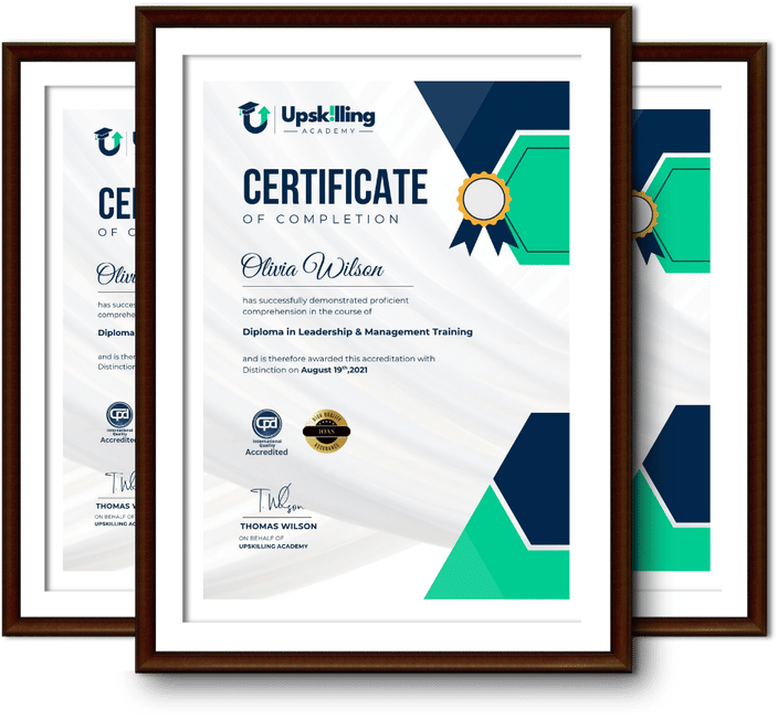
Framed Upskilling Academy certificates of completion

Course Reviews

Christine Ferguson

My experience with you was fantastic and easy to navigate. I'm looking forward to taking the course.

Jesse Harding

Provided highly informative and helpful responses, with quick and efficient replies.

Gary Schwartz

The course selection is broad, engaging, easy to follow, and offers a good challenge.

Bailey Burrows

Excellent course with user-friendly website navigation, making it easy to follow. I'm really enjoying the experience.

Benjamin Moreno

Great course with valuable information. Easy to follow, and I appreciated the flexibility to work at my own pace.

Quality Accreditation

  • incensu Registered Education Supplier
  • Association of Healthcare Trainers member
  • The CPD Group approved provider #790985
  • Disability Confident Committed

FAQ for Land Survey Level 3 Course

How do I access my course?

Once you complete your purchase, you’ll receive access to your course through your Upskilling Academy account. You can log in and access your learning materials online at any time.

How long do I have access to the course?

Your access period depends on the course and the package you purchase. Please check the course details or your order information for the applicable access period.

Can I study at my own pace?

Yes. Upskilling Academy courses are designed to provide flexible online learning, allowing you to study at a pace that suits your schedule.

Will I receive a certificate?

Certificate availability varies by course. Where a certificate is included, you’ll receive information about the requirements and how to obtain it within the course or upon completion.

Are the courses suitable for beginners?

Many courses are suitable for beginners, while others may assume some previous knowledge. Please review the individual course description for information about the recommended level and prerequisites.